
- Home
 Watersheds
 - Watersheds - Embarras
Watersheds - Embarras

Watershed Profile
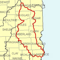
Name
Embarras
USGS Cataloging Unit
05120112
Description
The Embarras watershed in east-central Illinois is part of the Wabash River basin. With drainage from 12 counties, the watershed has a total area of approximately 2,440 square miles. Agriculture is the primary use of land within the watershed, especially in the upstream portion of the watershed. Approximately 10% of the watershed is forested areas located primarily along tributary streams in the mid through lower portions of the watershed.
Web Resources
- Embarras Watershed web links
- View all of the Embarras Watershed links in the ILRDSS database.
- Hurricane Creek (Station 601) Watershed Monitoring Data
- The Hurricane Creek station is part of the PILOT monitoring program, which collects hydrologic, sediment and nutrient data for selected watersheds in the State of Illinois.
Jump to another watershed
- Home
- | Data
- | Maps/GIS
- | Models
- | Publications
- | Research
- | Agencies
- | Visualizations
All files and information © 2018 Illinois State Water Survey. Disclaimer.
Email the Web Administrator with questions or comments.