Watersheds - Ohio River Valley


Watershed Profile
Name
Ohio River Valley
USGS Cataloging Unit
05140203, 05140206
Description
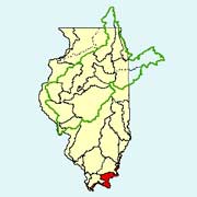
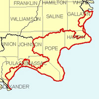
The Ohio River Valley in southern Illinois is the land area drained by the Ohio River, excluding the contributing drainage areas of its major Illinois tributaries: the Wabash, Saline, and Cache. Grasslands and forests cover the majority of the land in the watershed, but many agricultural areas are present as well.
Web Resources
- Ohio River Valley Watershed web links
- View all of the Ohio River Valley Watershed links in the ILRDSS database.
- Lower Ohio Watershed Water Data
- The USGS National Water Information System provides real-time and historical data on surface water flow, ground water levels, and water quality of streams in the US.
Jump to another watershed
- Home
- | Data
- | Maps/GIS
- | Models
- | Publications
- | Research
- | Agencies
- | Visualizations
All files and information © 2018 Illinois State Water Survey. Disclaimer.
Email the Web Administrator with questions or comments.

