
River - Des Plaines
River Profile!
Name
Des Plaines
Description
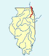
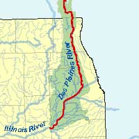
The Des Plaines River, a tributary of the Illinois River, is located in southeastern Wisconsin and northeastern Illinois. It is 134 miles in length and has a drainage area in Illinois of approximately 1,320 square miles. Its major tributaries include the DuPage River and Salt Creek. The Des Plaines River flows south from Wisconsin, passing through many of the suburbs of Chicago before meeting the Kankakee River to form the Illinois River near the border of Will and Grundy counties.
Web Resources
- Des Plaines River web links
- View all of the Des Plaines River links in the ILRDSS database.
Jump to another river
- Home
- | Data
- | Maps/GIS
- | Models
- | Publications
- | Research
- | Agencies
- | Visualizations
All files and information © 2018 Illinois State Water Survey. Disclaimer.
Email the Web Administrator with questions or comments.