
River - La Moine
River Profile!
Name
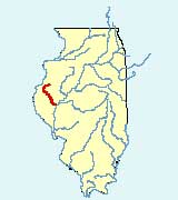
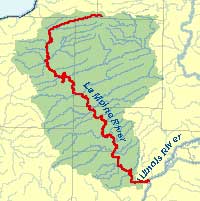
La Moine
Description
The La Moine River, a tributary of the Illinois River, is located in western Illinois. It is 125 miles in length and has a drainage area of approximately 1,350 square miles. Its major tributaries include Camp Creek and La Harpe Creek. The La Moine River flows south through seven counties and joins the Illinois River at the junction of Cass, Schuyler, and Brown counties.
Web Resources
- La Moine River web links
- View all of the La Moine River links in the ILRDSS database.
Jump to another river
- Home
- | Data
- | Maps/GIS
- | Models
- | Publications
- | Research
- | Agencies
- | Visualizations
All files and information © 2018 Illinois State Water Survey. Disclaimer.
Email the Web Administrator with questions or comments.