
Search Results
Search Results For:
All Maps/GIS
286 links were found.
Displaying Page 14 (of 15)
Page: [<< Prev] 1 | 2 | 3 | 4 | 5 | 6 | 7 | 8 | 9 | 10 | 11 | 12 | 13 | 14 | 15 | [Next >>]
Maps/GIS- 261 USDA Geospatial Data Gateway
- Provides natural resources GIS data
- 262 USGS Digital Raster Graphic (DRG) Files
- DRGs are offered in the original USGS designated coordinate system of Universal Transverse Mercator (UTM) Zones 15 and 16 (with map collar) and also the entire state in UTM Zone 16
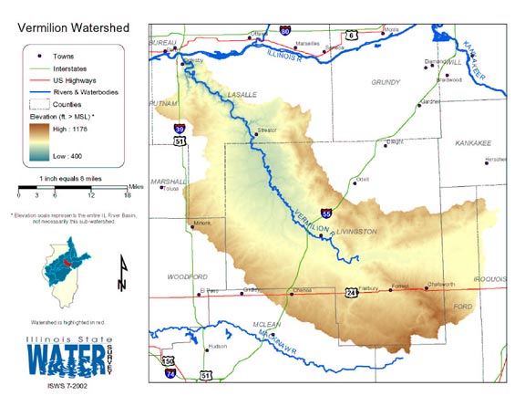
- 263 Vermilion (Illinois Basin) Watershed Map
- Thematic map of the Vermilion watershed showing roads, county boundaries, and elevation changes.
- Download Options: LoRes preview | HiRes (2.01 MB) | Metadata
- 264 Vermilion County Coal Maps
- ISGS Coal Map Series. Includes mines, resources, and logs.
- 265 Vermilion County Orthophotography Data 1998-1999
- Illinois National Aerial Photography Program Digital Orthophotography quarter Quadrangle data for Vermilion County in the Universal Transverse Mercator (UTM) coordinate system with a NAD83 datum.

- 266 Wabash County Coal Maps
- ISGS Coal Map Series. Includes mines, resources, and logs.
- 267 Wabash County Orthophotography Data 1998-1999
- Illinois National Aerial Photography Program Digital Orthophotography quarter Quadrangle data for Wabash County in the Universal Transverse Mercator (UTM) coordinate system with a NAD83 datum.
- 268 Warren County Coal Maps
- ISGS Coal Map Series. Includes mines, resources, and logs.
- 269 Warren County Orthophotography Data 1998-1999
- Illinois National Aerial Photography Program Digital Orthophotography quarter Quadrangle data for Warren County in the Universal Transverse Mercator (UTM) coordinate system with a NAD83 datum.
- 270 Washington County Coal Maps
- ISGS Coal Map Series. Includes mines, resources, and logs.
- 271 Washington County Orthophotography Data 1998-1999
- Illinois National Aerial Photography Program Digital Orthophotography quarter Quadrangle data for Washington County in the Universal Transverse Mercator (UTM) coordinate system with a NAD83 datum.
- 272 WaterWatch -- Current Water Resources Conditions
- USGS map of real-time streamflow compared to historical streamflow for the day of the year (United States)
- 273 Wayne County Coal Maps
- ISGS Coal Map Series. Includes mines, resources, and logs.
- 274 Wayne County Orthophotography Data 1998-1999
- Illinois National Aerial Photography Program Digital Orthophotography quarter Quadrangle data for Wayne County in the Universal Transverse Mercator (UTM) coordinate system with a NAD83 datum.
- 275 Wetlands Data on Google Earth
- The National Wetlands Inventory has developed a .kmz file that allows wetland data to be viewed with Google Earth.
- 276 Wetlands Interactive Mapper Tool
- Mapping tool developed by the US Fish and Wildlife Service, National Wetlands Inventory. The application displays national coverages of spatial themes such as land management, NWI data, GIRAS Land Use, and other basic geographic coverages in an interactive format.
- 277 White County Coal Maps
- ISGS Coal Map Series. Includes mines, resources, and logs.
- 278 White County Orthophotography Data 1998-1999
- Illinois National Aerial Photography Program Digital Orthophotography quarter Quadrangle data for White County in the Universal Transverse Mercator (UTM) coordinate system with a NAD83 datum.
- 279 Whiteside County Orthophotography Data 1998-1999
- Illinois National Aerial Photography Program Digital Orthophotography quarter Quadrangle data for Whiteside County in the Universal Transverse Mercator (UTM) coordinate system with a NAD83 datum.
- 280 Will County Coal Maps
- ISGS Coal Map Series. Includes mines, resources, and logs.
Page: [<< Prev] 1 | 2 | 3 | 4 | 5 | 6 | 7 | 8 | 9 | 10 | 11 | 12 | 13 | 14 | 15 | [Next >>]
- Home
- | Data
- | Maps/GIS
- | Models
- | Publications
- | Research
- | Agencies
- | Visualizations
All files and information © 2018 Illinois State Water Survey. Disclaimer.
Email the Web Administrator with questions or comments.