Search Results
Displaying Page 9 (of 9)
Page: [<< Prev] 1 | 2 | 3 | 4 | 5 | 6 | 7 | 8 | 9 |
Research and Programs- 161 Illinois Conservation Reserve Enhancement Program (CREP)
- Cooperative effort between landowners, state, local and federal agencies designed to enhance the Illinois River by protecting water quality and land in the Illinois River Watershed.
- 162 National Water-Quality Assessment Program: Lower Illinois River Basin
- Link to information collected from the lower Illinois River basin during the National Water-Quality Assessment (NAWQA) activities: basin info, ground water, surface water, bed sediment and fish tissue, ecology, maps, illustrations, photos, publications, and data retrieval.
- 163 Northeast Midwest Institute - Upper Mississippi River Basin Task Force
- This website contains legislative and other information relevant to the Upper Mississippi River Basin
Agencies/Organizations- 164 Association of Illinois Soil and Water Conservation Districts (State)
- The Association of Illinois Soil and Water Conservation Districts (AISWCD), is a grass roots organization formed in 1948. It is made up and serves Illinois 98 member Soil and Water Conservation Districts (SWCDs).
- 165 US Army Corps of Engineers - Rock Island District (Federal)
- The Districts missions include navigation, environmental preservation, flood control, regulatory functions, recreation, federal real estate management, mobilization for both federal disaster response and national defense, and emergency operations
Visualizations/Video| 166 | ![Ackerman Creek Aerial Flyover]() | - Ackerman Creek Aerial Flyover
- Video Flyover of Ackerman Creek, a tributary of the Illinois River located in the Illinois River Valley
- Resolution: 720x480 Format: WMV File Size: Broadband
|
| 167 | ![Farm Creek Aerial Flyover]() | - Farm Creek Aerial Flyover
- Aerial flyover video of Farm Creek, a tributary of the Illinois River located in the Illinois River Valley
- Resolution: 720 x 480 Format: WMV File Size: Broadband
|
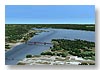
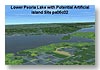
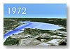
| 172 | ![Peoria Lake Aerial Flyover]() | - Peoria Lake Aerial Flyover
- Aerial flyover video of Peoria Lake, located along the Illinois River
- Resolution: 720 x 480 Format: WMV File Size: Broadband
|
| 173 | ![Spring Creek Aerial Flyover]() | - Spring Creek Aerial Flyover
- Aerial flyover of Spring Creek, a tributary of the Illinois River located in the Illinois River Valley, Tazewell county.
- Resolution: 720 x 480 Format: WMV File Size: Broadband
|
| 174 | ![Ten Mile Creek Aerial Flyover]() | - Ten Mile Creek Aerial Flyover
- Aerial flyover video of Ten Mile Creek, a tributary of the Illinois River located in the Illinois River Valley located in Woodford and Tazewell counties.
- Resolution: 720 x 480 Format: WMV File Size: Broadband
|
Page: [<< Prev] 1 | 2 | 3 | 4 | 5 | 6 | 7 | 8 | 9 |