
- Home
 Fox Project Home
- Tributary Watersheds - GIS Data
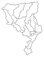
Fox Watershed - Tributary Watersheds - GIS Data
The following shapefiles (zipped) were created through BASINS automatic delineation and adjusted to reflect any changes due to inconsistencies in the elevation dataset, recent development, elevated roads or railroads, detention ponds, and other relevant features as needed, as part of the Fox River Watershed Investigation. Each zipped file contains additional metadata. Click on a specific file listed below to begin the download process.
Download all of the tributary watershed datasets in a single zipped file: All Watersheds and Subwatersheds
- Home
- | Data
- | Maps/GIS
- | Models
- | Publications
- | Research
- | Agencies
- | Visualizations
All files and information © 2018 Illinois State Water Survey. Disclaimer.
Email the Web Administrator with questions or comments.